ETL 1110-2-367
31 Mar 95
runoff models were used by the district to develop project
circular pipe just downstream from the Trancas Street Bridge.
discharge-frequency relationships for the Napa River.
This outfall is above the upstream limit of the project and
Therefore, the HEC-1 model-developed hypothetical flood
therefore will not be disturbed. The outlet invert is not subject
hydrographs were used for exterior conditions during HEA. The
to blockage from high river stages due to the relatively high
flood hydrographs were imported into HEC-IFH and used with
outlet invert elevation. It was estimated by the City of Napa
rating curves to compute exterior stage hydrographs at interior
that this outfall would pass a maximum of 50 cfs into the
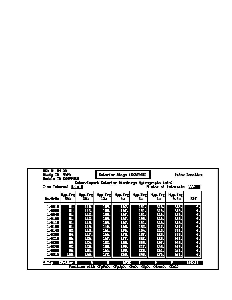
outlet locations during HEA. Figure D-10 shows a portion of
Napa River during flooding. This was simulated in HEC-IFH
the imported hypothetical flood hydrographs for the exterior
by diverting this flow from the upper subbasin to the river (see
paragraph D-4k).
basin.
g.
Existing and proposed storm sewer design and
(2)
The next downstream major storm sewer is a 72-
configuration. The details of existing and any proposed storm
in. circular pipe that enters the river at the north end of the Lake
Park leveed area, just east of the intersection of Soscol and
sewer layout, and discharge design capacities, including
Pueblo Streets. It serves a major portion of the upper subbasin
elevation of the inverts, were required to define drainage areas,
under pressure flow. This outlet is just upstream from the upper
minimum facilities, gravity outlet inverts, pumping station on-off
limits of the flood control project and, therefore, will be left
elevations, and design criteria for inlet and outlet works. Layout
undisturbed. The capacity of this pipe was estimated to be 300
and design of existing and proposed storm runoff conveyance
cfs and this flow was diverted from the upper subbasin to the
systems were obtained from the Napa Public Works
river for HEA and CSA (see paragraph D-4k).
Department. The information included storm sewer location,
length, size, and invert elevation. These data were provided on
an areal photo (1 in. = 100-ft scale) with 2-ft contour intervals.
(3)
The Lake Park/Edgewater leveed area and its
Interior Area 5 is well sewered and has several existing gravity
associated existing gravity outlets and pump station are
outlets that cross the line-of-protection and/or convey portions
considered independently and are not part of the Interior Area 5
of the runoff to the Napa River. The outlets are shown in
analysis.
Figure D-4 and are described in the following subparagraphs.
Numbered outlets refer to the primary and secondary outlet
(4)
The location 5.0 overflow ditch and 42-in. pipe
locations as shown in the figure.
north of the confluence of Napa Creek and the Napa River
system includes a 72-in. pipe that empties into an overflow ditch
(1)
A major storm sewer system runs easterly along
that enters the Napa River just upstream from the confluence of
Trancas Street and discharges into the Napa River via a 54-in.
Napa Creek and Napa River. At the outfall there is a 42-in.
Figure D-10. Portion of hypothetical flood hydrographs for exterior basin - HEA
D-9


 Previous Page
