ETL 1110-1-162
30 Sep 01
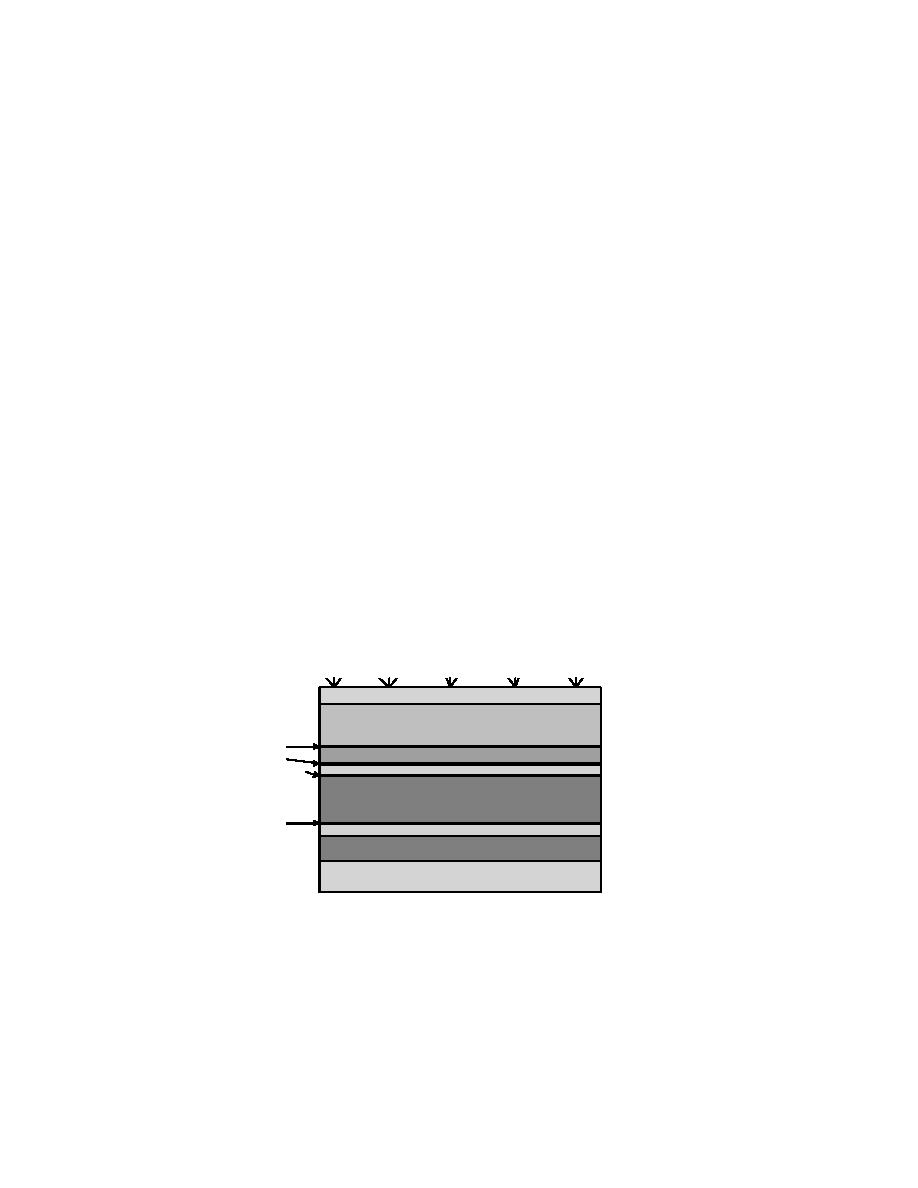
in Figure B-1.
B-2. Pre-design Investigations.
a. General. Prior to preparing a design analysis or plans and specifications for a landfill cover, it is
necessary to conduct pre-design surveys and investigations to fill data gaps. The existing database
available from the remedial investigation (RI), feasibility study (FS), and any other documents must be
reviewed before scoping a pre-design investigation. The following information is often required in the
design of a final cover.
b. Field Surveys and Record Searches.
(1) Aerial Photography. Historical aerial photographs can be used to preliminarily define the
nature and extent of a landfill. The principal sources of aerial photographs are the U.S. Department of
Agriculture (USDA) Natural Resource Conservation Service (NRCS), the U.S. Geological Survey
(USGS), and some military installations.
(2) Design and Operational Data. Design and operational information obtained from as-built
drawings, specifications, design analyses, and interviews of people associated with the site may help in
identifying the nature and extent of a landfill. Information obtained from these sources may not always
be readily available for existing hazardous waste sites.
(3) Map Database. The USGS, USDA, and other government agencies produce topographic,
soils, ground water, and other maps that may be useful in defining landfill boundaries and cover design.
Topsoil
Select Fill
Geotextile
Biotic Barrier
Geotextile
Drainage Layer
Geomembrane
Compacted Clay
Geotextile
Gas Vent Material
Random Fill
Waste
Figure B -1. Landfill cover with all optional layers.
(4) Topographic Surveys. Current topographic surveys of the project site are required. To
allow for manipulation of data and to expedite the design process, the topographic survey should be
mapped on a computer-aided design and drafting (CADD) system. Ideally, the topographic mapping
will have 300-mm (1-ft) contour intervals. However, larger contour intervals may be acceptable,
B-2


 Previous Page
